galleries
Visualize NASA Near-Earth Missions
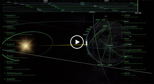
This representation by NASA’s Scientific Visualization Studio shows the orbits of NASA-related near-Earth science missions from the launch of the first U.S. satellite, Explorer 1, in 1958 through 2017. The missions include both NASA-run missions and those operated by NASA and partner organizations.
Highlighted in the visualization are 24 “firsts” including:
-
Explorer-1
first satellite launched by US -
Vanguard-1
first solar-powered satellite -
Tiros-1
first weather satellite -
Nimbus-1
first in series that provided 30 years of Earth observations -
ATS-1: Applications Technology Satellite
first full-disk Earth images from geosynchronous orbit -
Apollo-8
first humans to orbit Moon; Earthrise photo -
Landsat-1
first in a series providing continuous coverage of Earth's land -
Skylab
first combined active/passive microwave sensor, RADSCAT -
Seasat-1
first Oceanographic Satellite -
ERBS: Earth Radiation Budget Satellite
ozone data was key in Montreal Protocol Agreement -
TOPEX/Poseidon: Ocean Topography Experiment
continuous record of global “sea surface height measurements” -
SeaWiFs: Sea-Viewing Wide Field-of-View Sensor
first to measure global biosphere -
TRMM: Tropical Rainfall Measuring Mission
first 3-D view of storms from space
-
Terra
first spacecraft of Earth Observing System (EOS) -
SRTM: Shuttle Radar Topography Mission
first near-global data set of land elevations -
GRACE: Gravity Recovery and Climate Experiment
first Long-term measurements of Earth’s shifting water -
Aqua
first spacecraft in afternoon-train -
ICESat: Ice, Cloud,and land Elevation Satellite
first continuous laser altimetry of Antarctic and Greenland ice sheets -
CALIPSO: Cloud-Aerosol Lidar and Infrared Pathfinder Satellite Observation
first global survey of cloud & aerosol profiles from 2 spacecraft -
Cloudsat
first global survey of cloud & aerosol profiles from 2 spacecraft -
Aquarius
first dedicated sea surface salinity measurements -
GPM: Global Precipitation Measurement
first near-global precipitation observations -
OCO-2: Orbiting Carbon Observatory-2
first high-precision global measurements of CO2 -
SMAP: Soil Moisture Passive Active
first NASA soil moisture satellite -
DSCOVR: Deep Space Climate Observatory
first continuous daytime observations from L1

